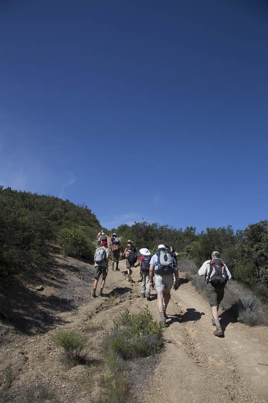
On Saturday, May 3rd, 9 scouts and 4 adults, went on a 7 mile round trip hike to Gaviota Peak. Originally we were supposed to go to Seven Falls, but it was deemed not to be the right conditions for that trip.
We met at Big 5 at 7:00 and started our hike at 8:15 after driving about 30 minutes to the trail head.
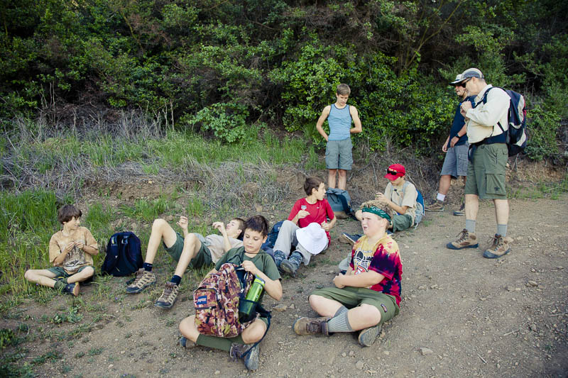
On the trip were newly bridged scouts Alex, Ryan and Kellen. We also had several older scouts including Max, Cameron, Jeremiah, Timmy, Wesley, and myself. With us, there were four daring adult leaders who stayed towards the back. They said they stayed towards the back to make sure no scouts got left behind.
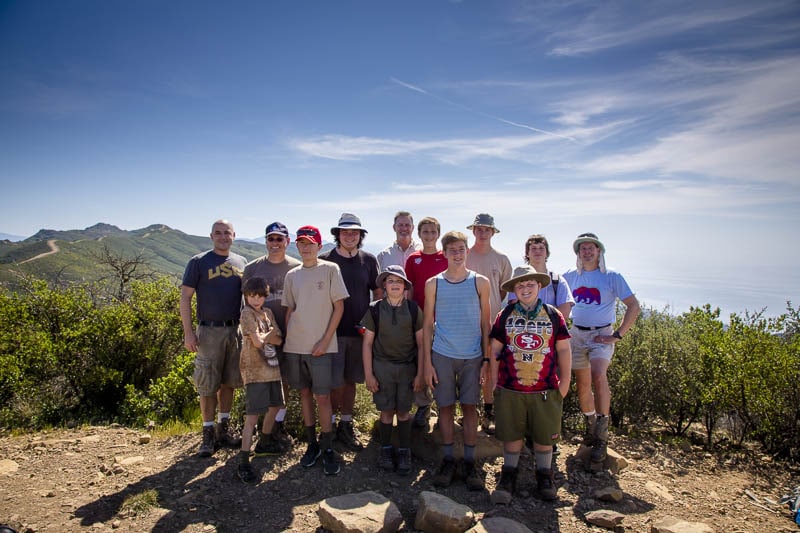
We passed a natural hot spring but we did not follow that part of the trail. We encountered poison oak along the hike but nobody came into contact with it. We all reached the peak at around 10:25am and had lunch with some delicious friendship bread made by Mrs. Soga and delivered by Mr. Soga. Mr. Shaw carried the bread in his backpack for us as Mr. Soga was unable to join us.
There was another group of adult hikers on the trail and we shared the peak with them while they took a break. Before we headed down the trail, we picked up some garbage left by other hikers. We made sure that we left the area cleaner than how we found it.
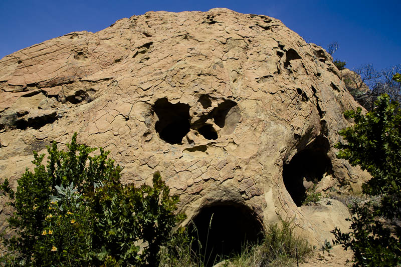
On the way down, the scouts hiked much faster than most of the adults. To be safe, we stopped and waited for the rest of the adults to catch up with us. We found a really cool cave to wait in so we were out of the sun and got to rest in the shade.
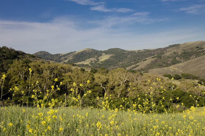
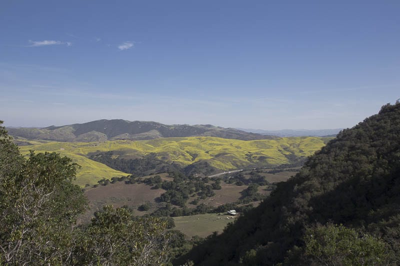
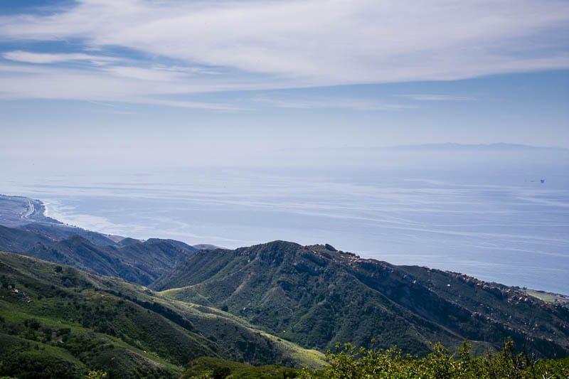
The round trip hike to Gaviota Peak had great views and there were many hikers along the path. The beginning elevation was approximately 400. At the peak, the elevation is listed at 2,458, so for those scouts that went on this hike, we will get about 2,000 feet for our hiking altitude.
By the time we left the parking lot to go home it was around 11:50 and got home at 12:20. After, we all left for a weekend still ahead of us.
If you are interested in doing this hike, here is a map that I found from another hiker (not from Troop 26) that shows the hike on Google Maps. The directions from the map creator aren’t exactly how we did the loop, but they are close and will give you an idea.
View Gaviota State Park GPS in a larger map
By Nathan Wong