January 17, 2014 (Friday)
Mr. Pinner and Mr. Soga loaded all the food and troop cooking gear to their vehicles on Friday evening.
January 18, 2014 (Saturday)
Saturday at 5:20 am, we left Santa Barbara and headed out to Death Valley. There were 8 vehicles, 22 scouts, 11 adults, and 1 cub scout. Mr. Forte, who was scheduled to go on this trip, had a conflict with his work schedule, so he will meet us at Furnace Creek Camp tonight.
We drove down Hwy. 101 through Hwt,134 and I-210 to Rancho Cucamonga and stopped at McDonald’s for quick breakfast. Then I-210 to I-15, path through Victorville, Barstow, and fuel stop at Baker before we headed for Death Valley.
We took Hwy. 127 North and passed Shoshone and Hwy. 178 West and entered Death Valley.
We stopped at Slot Canyon and stretched our legs, ate lunch and explored Slot Canyon. There are some 5 Slots, or canyons, there. Some of canyons are so narrow we had to use hands and legs to crawl through between the walls. Some walls are 50 to 60 feet up both sides with a narrow passage of a couple of feet. We explored there for about an hour and then drove to Furnace Creek Campgrounds.
Mr. Forte arrived late in the afternoon to join us at the Furnace Creek Campsite.
After setting up our camp and troop community kitchen, scouts prepared dinner. There were vegetables and dip, chips and salsa before dinner.
Some scouts played card games and some played chess. Then we had spaghetti and meatballs for the main course. Other scouts prepared Dutch Oven Peach Cobbler for dessert. Mr. Pinner prepared a duty roster and it worked very well.
After great dinner with all well fed, we had a camp fire and most of the scouts hit their tent by 9:30 pm.
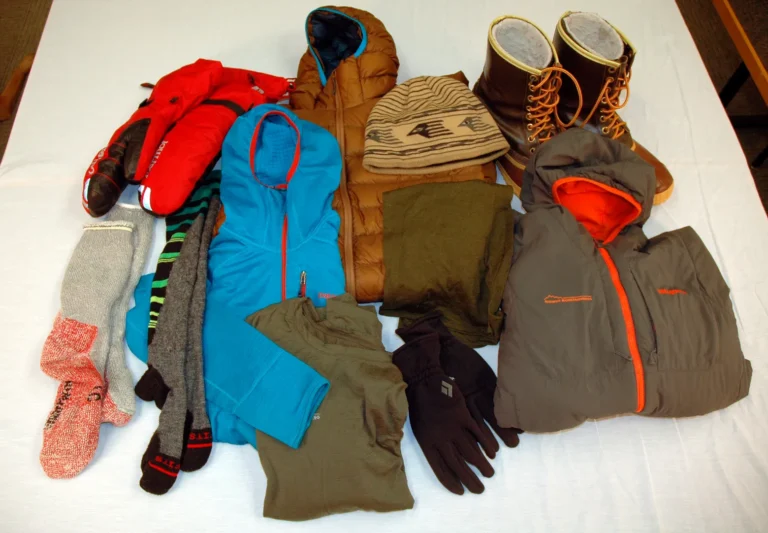
The sky was clear and it was quite cool in the evening. Probably low 50’s to upper 40’s in the early evening and it dropped to mid 30’s in the early morning.
The waning gibbous moon came up around 9:30 pm from the east, over the Funeral Mountains and lit up Death Valley. There were lots of Coyote calls during the night.
January 19, 2014 (Sunday)
The morning air was quite chilly, probably in the upper 30’s. We were up just before 7:00 am and the scouts prepared French Toast and Sausage for breakfast.
After we cleaned up our kitchen, each scout and adult made a sandwich for lunch. There was Peanut Butter and Jelly, cold cuts (ham and turkey), lettuce and tomato, bag of chips, oranges and apples to go with our sack lunch.
Today’s plans are drive up to Dantes View, Compass Hike to Zabriskie Point, Devils Golf Course. Drive through Artists Palette.
We drove to Dantes View. The view from here to Death Valley is wide open with the Panamint Range to the west with snowcapped Telescope Peak (11,049 ft.), Funeral Mountains and Greenwater Range to the west.
A few scouts, including Mr. Ensign and Mr. Pinner, tried to fly a kite there. The wind from the south-east was not really co-operating. However, Mr. Ensign’s kite went up high. The smallest kite was Nicholas Swanson’s kite. No more than 4-square inches.
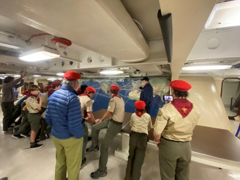
Next adventure is our famous “Map and Compass hike to Zabriskie Point. The rule is four patrols, each patrol in four different vehicles. At some point, the driver will inform each scout to put on a blind fold. Then they drive to the designated location and drop the scouts off. Then each patrol has to find where they are on the map and find a way to Zabriskie Point.
Mr. Pinner informed all participants of the rules and handed out with a walkie-talkie to each patrol. The call signs are the patrol names and the central station is King-pin.
Mr. Pinner lead four drivers with Bats, Crocs, Foxes, and Panthers in each vehicle. Then he drove around the road and pointed to each driver for their drop off point. Then all drivers and adults headed to Zabriskie Point. The Zabriskie Point is just off SR190 and short walk from the parking area.
Mr. Pinner called each patrol with the walkie-talkie and checked that they were on the way to Zabriskie Point. The hardest route was hiked by Fox Patrol. They hiked the ridge line and came up near Mandy Beacon, about 0.8 mile NW of Zabriskie Point.
The group met at the parking area and then we drove to Devils Golf Course. Here, Crystalized Salt, formed into sharp ridges and spires, the result of evaporation.
After half an hour at Devils Golf Course, we drove through Artists Palette. Natural pigments and mineral oxidation have produced splotches of color in eroded ancient lakebed sediments.
The dinner for this day was salad, and beef taco. (Thanks to Mrs. Pinner for preparations) Scouts reheated ground meat, chopped tomatoes, and the table was set up with beans, salsa, cheese, chopped olives, chopped jalapeño, and hot sauce. Scout reheated corn tortillas also. After dinner, we had Mrs. Soga’s “Friendship Bread” for dessert.
Mr. Wong decided to drive up to Zabriskie Point to take night time photo and invited interested parties. So several scouts and adults drove to Zabriskie Point. They spent about an hour at Zabriskie Point and took several pictures under the instruction of Mr. Wong. They came back to the camp around 10:00 pm when the moon started to rise over the Funeral Mountains.
January 20, 2014 (Monday)
After a breakfast of Bagel and Cream Cheese, Hot Oat Meal, and Cold Cereal, we all assembled our lunch and cleaned up the campsite. We loaded up our vehicles and headed for Mesquito Flat Sand Dunes. Each scout (and some adults) carried various boards and hiked to the highest point of the sand dunes. Mr. Wong and Mr. Soga detoured around and took some photos.
The sand dune were almost 200-ft. in height and had about a 40 degree slope. The scouts hiked up the dunes, then would sled down on their boards. It only takes a few seconds to sled down, but several minutes to hike back up since the soft sand and slope were hard to hike up.
We spent a couple of hours jumping and sliding the sand dune. Just after noon, we assembled at the top of the dunes and took a group picture and then hiked back to our vehicles at the parking area. It was about 1.5 miles of soft sand hiking.
We left Sand Dunes and drove SR190 past Panamint Valley, over Darwin Plateau at 5,000 ft. elevation and down to the junction of Hwy. 395 south of Owens Dry Lake. We stopped for fuel and headed to Palmdale for Pizza dinner.
We all arrived St. Mark’s at 7:46 pm (Mr. Pinner’s prediction was 7:45 pm). Unloaded all the equipment and everybody went home safely. Lots of driving but we all had a great time at Death Valley.